


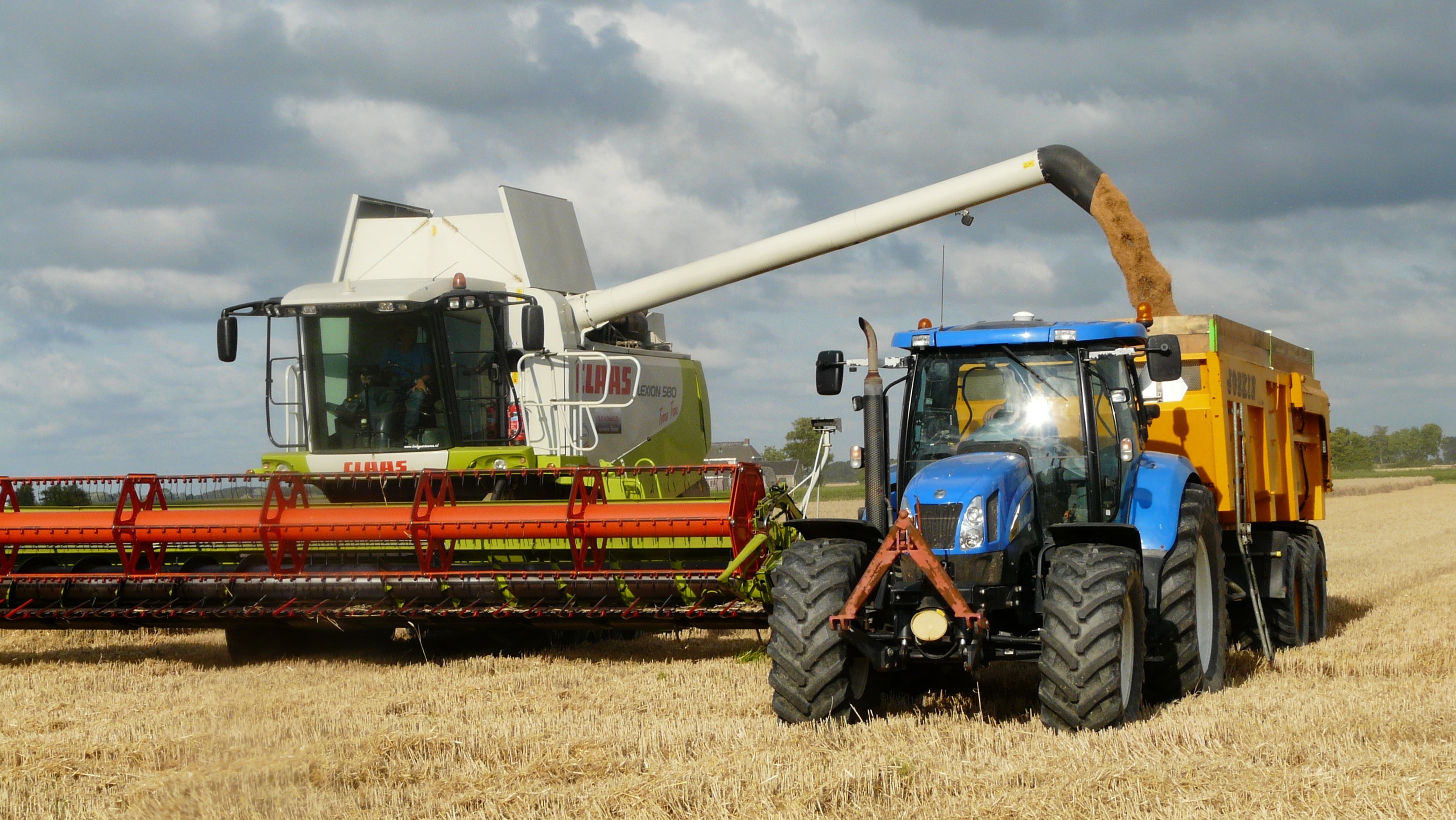
Agro-processing
Tourism

Educational Institutions
Regional Economic and Investment Synopsis
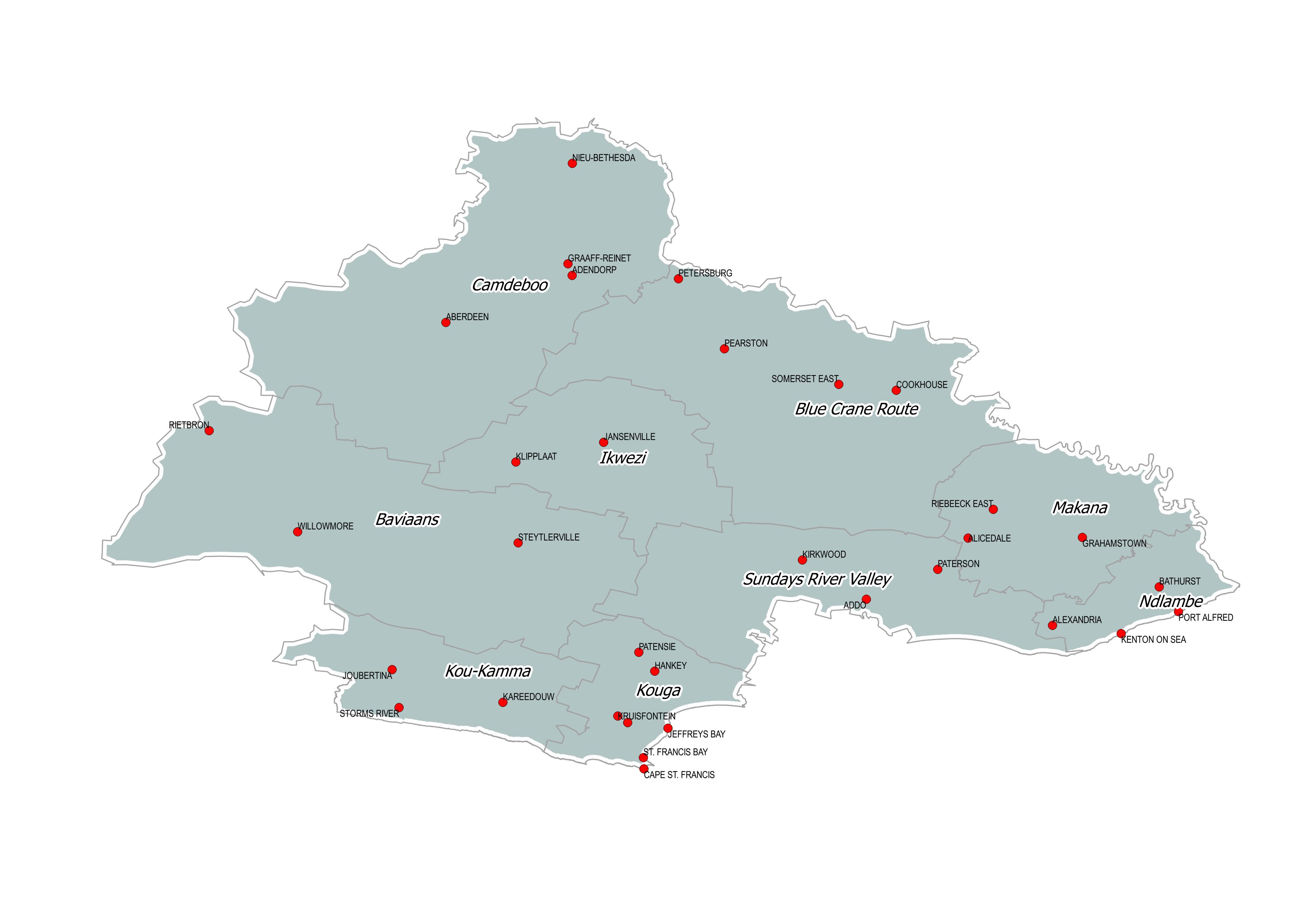
The Sarah Baartman District Municipality (SBDM), is the largest (58 243 km2) of the six (6) District Municipalities in the Eastern Cape Province. The District is situated in the western portion of the Province, bordering the Western Cape, Northern Cape and two other District Municipalities in the Eastern Cape, namely Chris Hani District Municipality and Amathole District Municipality. The District consists of seven (7) local municipalities and three other portions that are National Parks, namely the Addo Elephant National Park, the Tsitsikamma National Park and Camdeboo National Park.

Automotive
Export opportunities
Agro-processing
Tourism
Educational Institutions
Regional Economic and Investment Synopsis
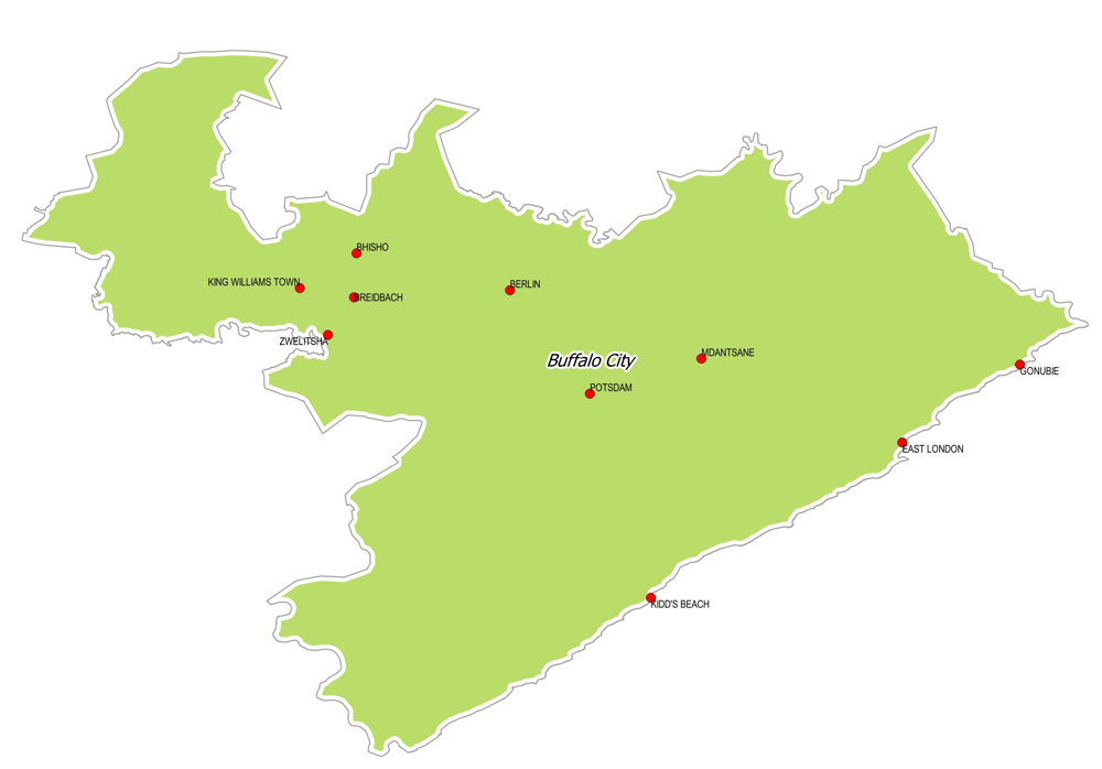
Buffalo City Metropolitan Municipality is situated relatively centrally in the Eastern Cape Province, and is surrounded by the Great Kei Local Municipality, Amahlati Local Municipality, Nkonkobe Local Municipality and Ngqushwa Local Municipality. It is bounded to the south-east by the long coastline along the Indian Ocean.
Buffalo City is a metropolitan municipality situated on the east coast of the Eastern Cape Province, South Africa. It includes the towns of East London, Bhisho and Qonce (previously known as KWT), as well as the large townships of Mdantsane and Zwelitsha. The area has a well-developed manufacturing base, with the auto industry playing a major role. Daimler AG through its wholly subsidiary Mercedes-Benz South Africa (MBSA) has a large assembly plant located next to the port of East London, which produces a variety of vehicles for export.
Automotive

Services

Pharmaceutical
Agro-processing
Tourism
Educational Institutions
Regional Economic and Investment Synopsis
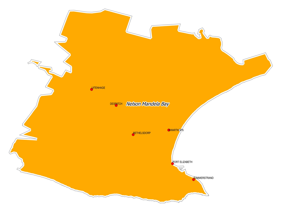
The municipality houses a lot of export-oriented opportunities in the automotive value chain (vehicle assembly, manufacturing of components, parts and accessories) leveraging off the ports of Coega SEZ and Port Elizabeth.
Opportunities include:
- Services opportunities (finance, insurance, R&D,education/training service providers, general business support services, BPO).
- Manufacture of communications, medical, transport and other automotive sector related equipment. Textiles and clothing manufacturing.
- Renewable energy, gas and steam infrastructure. Mining (manganese) and related services
- Wood products, paper, publishing
- Tourism development, including sports tourism
Agriculture

Forestry
Tourism
Regional Economic and Investment Synopsis
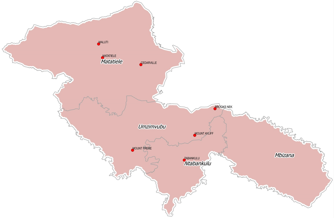
The Alfred Nzo District covers the north east of the Eastern Cape, bordering Lesotho and Kwa-Zulu Natal and incorporates towns like Matatiele, Maluti, Mount Ayliff and Mount Frere. Mbizana municipality is the district’s gateway to the Wild Coast and has a medium sized town at Bizana. The district has a very mountainous terrain. The land form of the district is generally rugged, with parts of it characterized by steep slopes and high elevations. The topography has implications on the district’s natural, social and economic environment.
Agriculture
Tourism
Service Sector
Educational Institutions
Regional Economic and Investment Synopsis
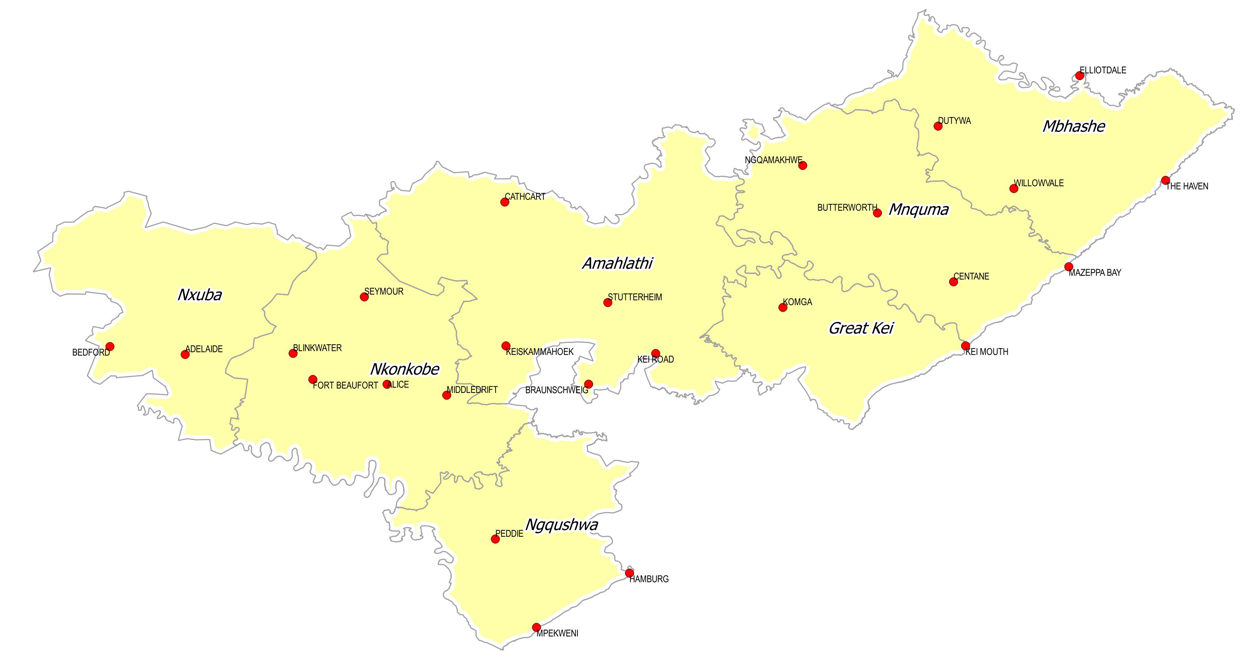
The Amathole District is situated in the central part of the Eastern Cape, stretching along 200kms of coastline from the Fish River Mouth to just south of Hole in the Wall. It is bordered in the north by the Amathole mountain range, which together with its other natural resources in the form of grasslands, estuaries, forests, waterfalls and beaches, give it its distinctly rural nature.
Agriculture
Oceans Economy
Mining
Regional Economic and Investment Synopsis
The O.R. Tambo District Municipality (ORTDM) is one of the six District Municipalities in the Eastern Cape (EC) Province, located in the eastern half of the province, with its eastern border being the Indian Ocean coastline of South Africa (SA). To the north, it is bordered by the Alfred Nzo District Municipality, to the northwest, by the Joe Gqabi District Municipality, to the west, by the Chris Hani District Municipality, and to the southwest, by the Amathole District Municipality.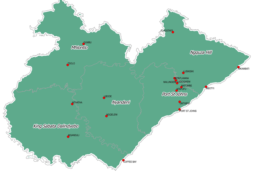
Agriculture
Forestry
Regional Economic and Investment Synopsis
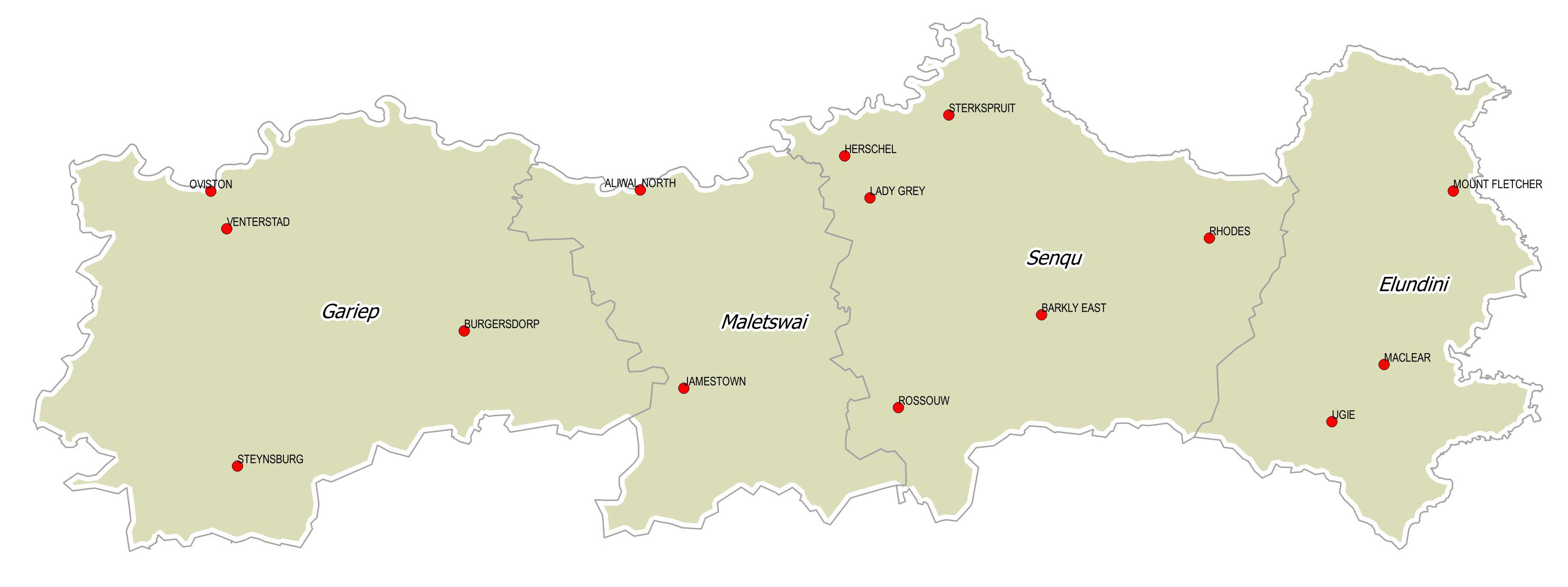
The Joe Gqabi District Municipality is located in the north eastern part of the Eastern Cape and is bordered by the Alfred Nzo District Municipality, the O.R. Tambo District Municipality and the Chris Hani District Municipality to the south. The Joe Gqabi District Municipality shares a border with the Free State, the Northern Cape and Lesotho. Joe Gqabi DM located in the northern region of the Eastern Cape
Agriculture
Tourism
Mining
Educational Institutions
Regional Economic and Investment Synopsis
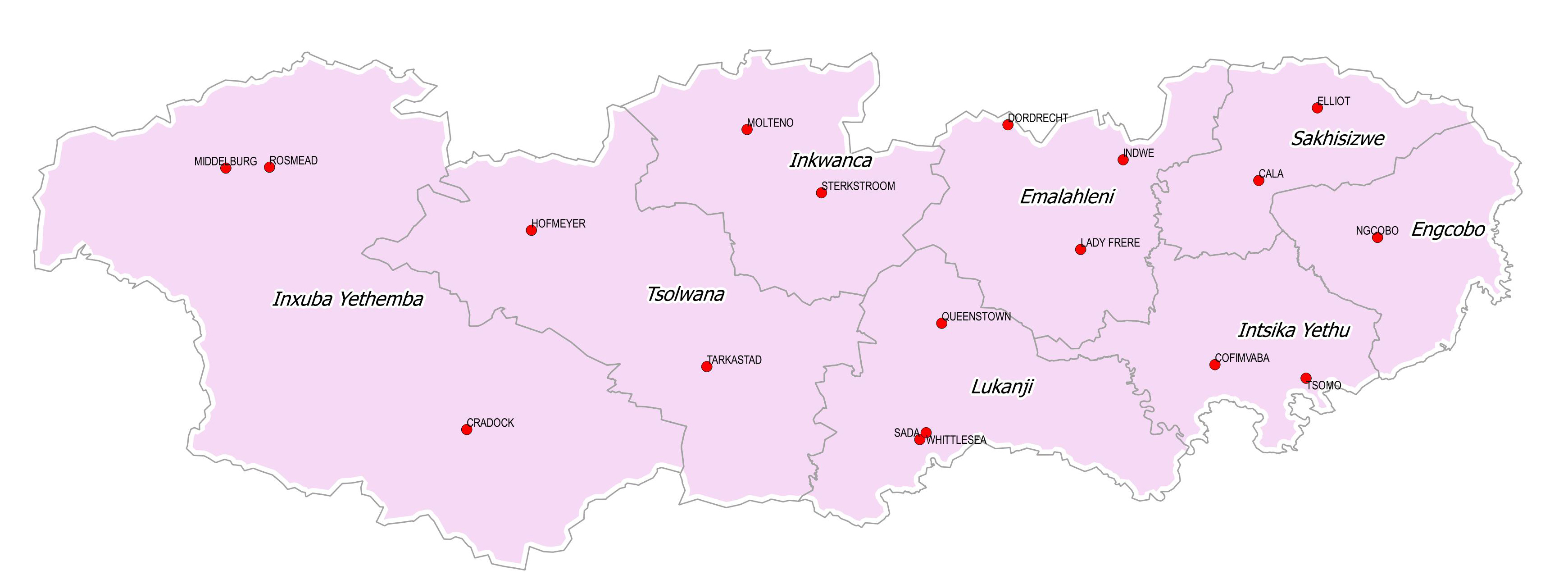
The Chris Hani District is a land-locked district situated in the centre of the Eastern Cape hinterland, between the Eastern Cape coastline and the Drakensberg Mountains. Chris Hani is the second-largest district in the province, making up almost a third of its geographical area. Chris Hani is bordered by four districts, which are Sarah Baartman, Amathole, OR Tambo and Joe Gqabi District and the Prixley kaSeme District in the Northern Cape. The road network in the Chris Hani District consists of a hierarchy of national, provincial and municipal roads. Three national routes pass through the Chris Hani District in a north-south direction i.e. the N10, N9 and N6